

Kashmir Is Disputed for Google But Not in India

And it is not just Kashmir. Borders of several countries look different on Google Maps depending on where people view them from, said the report on Friday.
This is because Google as well as other online map makers change them.
According to Google, it follows local legislation wherever local versions of Google Maps are available.
“Our goal is always to provide the most comprehensive and accurate map possible based on ground truth,” Ethan Russell, Director of Product Management for Google Maps, was quoted as saying in a statement by The Post.
“We remain neutral on issues of disputed regions and borders, and make every effort to objectively display the dispute in our maps using a dashed gray border line. In countries where we have local versions of Google Maps, we follow local legislation when displaying names and borders,” Russell added.
However, Google’s map making also gets influenced by “the shifting whims of diplomats, policymakers and its own executives”, said the report, citing people familiar with the matter.
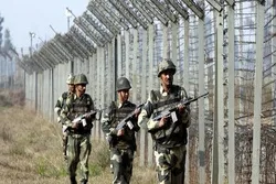
Muslim-majority Kashmir is a disputed territory divided between India and Pakistan but claimed in its entirety by both sides.
